Peakirk Archaeological Survey Team (PAST)
PEAKIRK ARCHAEOLOGY SURVEY TEAM
PAST is a self-funding, independent group, founded in 2013 by Greg Prior, Bob Randall and Dr Avril Lumley Prior following two successful ‘digs’ in Peakirk led by Dr Carenza Lewis [ex-Time Team]. Since then, PAST had been enhanced by other talented recruits. Our aims are to learn more about Peakirk’s rich heritage through the analysis of a variety of sources (including written and landscape evidence), non-invasive geophysical surveys and, where viable, excavations. Crucially, we always record our findings for posterity as both formal archaeological reports and light-hearted features in The Village Tribune. We also give regular updates and presentations in order to generate an interest and pride in Peakirk’s past and an understanding of how this small settlement fits into the ‘bigger picture’.
CAR DYKE
A major project in 2016 was exploring the course of the Roman waterway known as Car Dyke as it made its way through Peakirk, which culminated in the information board erected on the village green.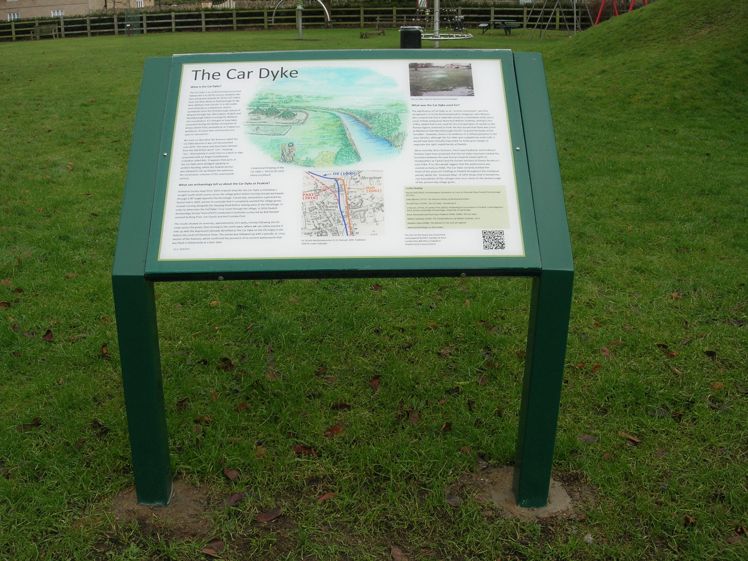
What was it?
The Car Dyke is an artificial watercourse which follows the 6m [19.5’] contour between the fens and gravel uplands for 92km [57 miles], from the River Nene at Peterborough to the River Witham near Lincoln. It is still visible intermittently as a depression and/or earthworks from the Peterborough suburb of Newark, through Eye, Werrington, Peakirk and Northborough before crossing the Welland into Lincolnshire. It is thought to have been excavated during the Roman occupation of Britain (43-410AD), probably by the indigenous workforce. Its exact date and function are open to speculation.
We have no idea what the Romans called the Car Dyke because it was not documented until 1075. The name may be derived from the Old-British word ‘carr’ meaning ‘fen’. Alternatively, it could refer to a ditch or dike associated with an Anglo-Scandinavian individual called Kárr. It appears that parts of the Car Dyke were dredged regularly to prevent flooding, whilst the Peakirk section was allowed to silt up despite the extensive fen-reclamation schemes of the seventeenth century.
What was it used for?
The significance of the Car Dyke as an ‘ancient monument’ was first recognised in 1712 by Northamptonshire clergyman, John Morton, who conjectured that it originally served as both a catchwater drain and a canal. Fellow-antiquarian Reverend William Stukeley, writing in the 1740s, added that it was used for the transportation of cereals to the Roman legions stationed at York. He also mused that there was a fort at Walderam Hall [Northborough parish] ‘to guard the boats of the Carsdike’. However, there is no evidence of a military presence in the area. Besides, although the Car Dyke was navigable by small craft, it would have been virtually impossible for bulky grain-barges to negotiate the right-angled bends at Peakirk.
More recently, Brian Simmons, Paul Cope-Faulkner and Professor Stephen Upex have proposed that the Car Dyke may have marked the boundary between a vast Roman Imperial estate (with its headquarters at Castor) and the former territory of Queen Boudicca and the Iceni Tribe. If so, this would suggest that the watercourse possibly was created as early as c.60AD. The Car Dyke certainly marked the limits of peasants’ holdings in Peakirk throughout the medieval period, whilst the ‘Inclosure Map’ of 1819 shows that it formed the rear boundaries of the cottages that once stood on the western edge of the present village green.
What can archaeology tell us about the Car Dyke at Peakirk?
Ordnance Survey Maps from 1824 onwards describe Car Dyke as following a straight north-south course across the village green before turning sharply westwards through a 90˚ angle opposite Peakirk Hermitage. Conversely, excavations supervised by Rachel Hall in 2002, led her to conclude that it completely avoided the green, instead running alongside the Deeping Road before veering westwards at The Hermitage.
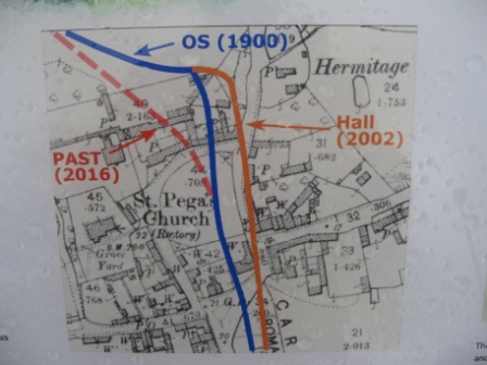
In order to determine the Car Dyke’s true route through the village, in 2016 Peakirk Archaeology Survey Team [P.A.S.T] conducted a resistivity survey led by Bob Randall assisted by Greg Prior, Jon Clynch and Avril Lumley Prior. The results showed an anomaly, approximately 12m wide initially following the OS route across the green, then turning to the north-west, where we can safely assume that it links up with the depression (already identified as the Car Dyke on the OS Maps) in the field to the north of Chestnut Close. The survey was followed up with a pseudo- or cross-section of the feature, which confirmed the presence of an ancient watercourse that was filled in deliberately at an unknown date.
The Car Dyke in Thurlby, (north of Bourne) is still a functioning water course.
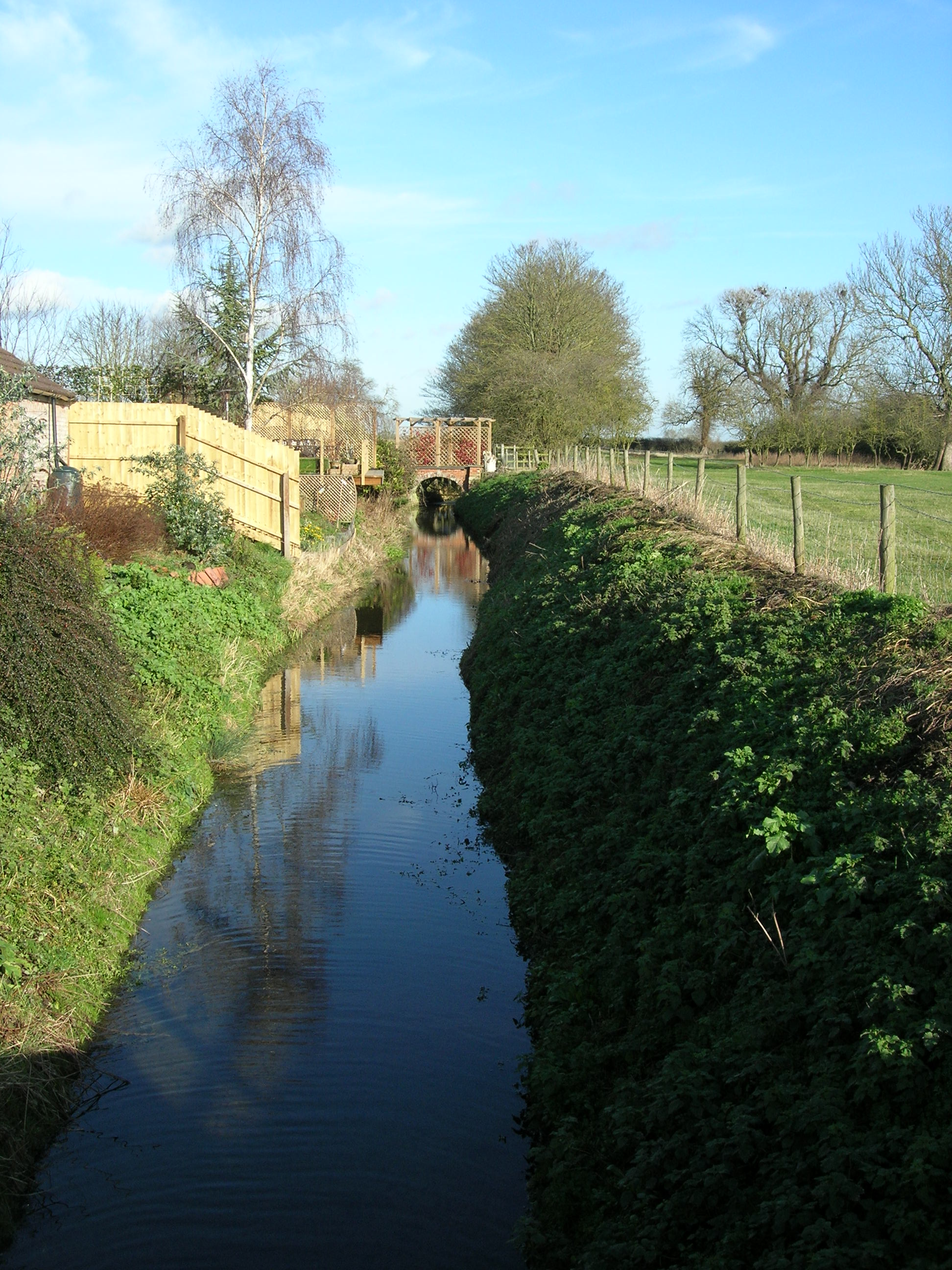
The shallow course of Car Dyke crossing the field known as Bundfield as it extends towards the village green.
Photo by Bob Randall
Further reading
Rachel Hall (2002): Archaeological Evaluation on Land at Chestnut Close, Peakirk, Peterborough (PCC02).
John Morton (1712): The Natural History of Northamptonshire.
Arnold Pryor (1978): The Car Dyke, Durobrivæ 6.
- Ranson, A. Pryor and A. Lumley Prior, A. (2016): Archaeological Excavations in Peakirk, Cambridgeshire, 2012, Access Cambridge Archaeology, University of Cambridge.
Brian Simmonds and Paul Cope-Faulkner (2004, 2006): The Car Dyke.
William Stukeley (1883): The Family Memoirs of William Stukeley, vol. II.
Stephen Upex (2008): The Romans in the East of England.
The text for the information board was researched and prepared by P.A.S.T member, Dr Avril Lumley Prior MA, PhD, on behalf of Peakirk Parish Council (2016)
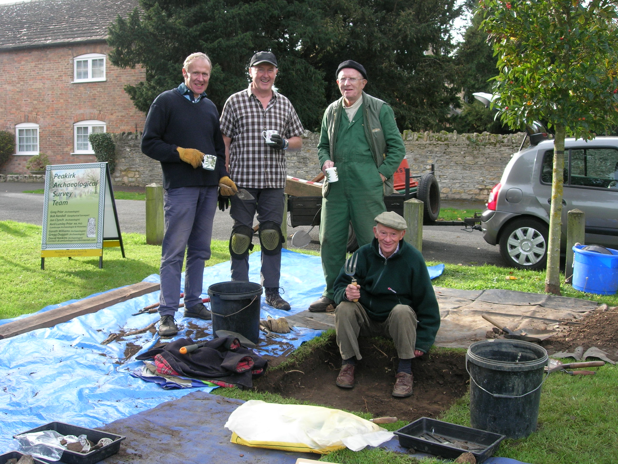
A Test Pit on the Village Green 2017
Featuring David Dearman, Greg Duggan, David Hankins, Greg Prior, Gareth Williams and behind the camera, Avril Lumley-Prior.
A Lecture given at Oundle Methodist Church on 4 May 2018
Probing Peakirk’s Past: The Archaeology of a Fen-edge Settlement
Speaker: Dr Avril Lumley-Prior
Lecture outline
Peakirk is a rural settlement on the western margins of Borough Fen, formerly in the Soke of Peterborough, Northamptonshire, now in Cambridgeshire. The place-name is derived from St Pega, ‘England’s’ first anchoress, who reputedly founded a cell here in the early 800s. Whilst Peakirk’s history is well-documented from the eleventh-century onwards, archaeological evidence indicates that the area first was colonised by Neolithic folk and that there was almost-continuous activity in the heart of the present village from the Romano-British period onwards.
Dr Prior will tell Peakirk’s story through a combination of archaeology, architecture, cartography, topography, photographs and written sources. It also features the work of PAST (Peakirk Archaeological Survey Team), an independent, self-funding group, whose recent projects have included re-plotting the route of the Roman watercourse, the Car Dyke, dispelling the ‘tradition’ of a Romano-British villa, rediscovering ‘lost’ buildings and revealing more about Peakirk’s diverse and secret heritage.
PEAKIRK UNWRAPPED : The P.A.S.T. YEAR’S WORK
Dr Avril Lumley Prior
A Sense of the Past
As long as I can remember, I have been fascinated by the past. Perhaps, it is because I grew up in a seaside village that has retained its late Anglo-Saxon footprint of three streets arranged around a triangular green. At school, we were taught that, in times of invasion by ‘Vikings’ or cattle rustlers, livestock was driven onto the green and the roads were blocked. (The strategy cannot have worked because a charter of 935AD discloses that King Æthelstan had to liberate Reoffhopa from the Scots.) Three miles down the coast at Seaham is the seventh-century church of St Mary. Another three miles to the north at [Monk]wearmouth stood St Peter’s Monastery, where Bede (c.674-735) was taken as a seven-year-old oblate, thereby launching an illustrious career that culminated in his masterwork, The History of the English Church and People. As you may have realised, my interest in all things Anglo-Saxon is very deep-rooted.
In January 2013, Greg (my husband), Bob Randall, John Clynch and I formed P.A.S.T. [Peakirk Archaeological Survey Team] with the objective of researching, recording and promoting the settlement’s intriguing history both above and below ground. For whilst Bede was beavering away in the relative comfort of the prestigious Wearmouth-Jarrow Monastery, Pega, a Mercian noblewoman and sister to St Guthlac the hermit of Crowland, was leading a severely-abstemious life in the obscurity of the undrained Fens. In the early-eighth century she pitched her hermitage in the place which eventually became known as Peakirk [‘Pega’s church’]. Thus, P.A.S.T. has 1300 years of her legacy to uncover. Plenty to keep us out of mischief for the foreseeable future!!!
P.A.S.T. Projects 2016-17
Undeniably, our last year has been exceptionally busy. We have recruited Gareth Williams, a hands-on Peakirk archaeologist with a good working-knowledge of ceramics. We also have two more potential members in David Hankins also of Peakirk and Gregg Duggan of Glinton, who have already proved their worth. Apart from the Car Dyke Visitors’ Interpretation Board, P.A.S.T. has been embroiled in two riveting archaeological projects. One is on the reputed site of a Romano-British villa in Bull Lane (which Greg is going to tell you about). The second is on the eastern edge of Chestnut Close, where a row of cottages once stood. There also have been several somewhat-serendipitous, ‘rainy-day’ revelations. After hours spent in libraries pouring over old manuscripts and maps, we have realised that what we were searching for was right under our very noses! In effect, we have accidently stumbled upon Peakirk’s ‘London Road’ and St Pega’s medieval church bells; and, over the course of our investigations, have begun to have serious doubts whether Pega was buried in Rome, where she purportedly died, in 719.
Peakirk’s ‘London Road’
Hanging on my sitting-room wall is a delightful little road map, published in 1720 by John Owen and Emanuel Bowen in their atlas, Britannia Depicta [Britain Portrayed]. It shows the Stilton to Donnington section of the old post-road between London and Lincoln via Boston used by horsemen [post-riders] to carry mail between the two major cities, similar to the Pony Express in the Wild West. The route followed the Great North Road [the present A1] as far as Stilton, where it turned onto the old Lincoln Road and continued through Yaxley, Peterborough and Werrington to Glinton. Thence, it followed the course of the modern B1443 as far as Peakirk’s, Thorney Road, past the erstwhile Boat Inn and over the Folly River. From there, the post-road was carried along eastern embankment of the River Welland [Corporation Bank] as far as Spalding.
The Peakirk-Spalding section probably came into use in c.1650, when the river was straightened and embanked as a flood-defence during the massive seventeenth-century drainage of the Fens. The road certainly existed in 1670, when Deeping Fen was surveyed by Vincent Grant. In 1792, it was up-graded to turnpike status to provide a safer passage for mail coaches and private carriages by a consortium of wealthy entrepreneurs who levied tolls to pay for its upkeep. Although the Turnpike Trust was dissolved 30 years later, tolls were still being charged at Peakirk on cars and cycles until 1929 and on horses and cattle until 1947.
The Peakirk to Glinton element of the road is considerably older for here, Greg and I did a spot of field-work, applying Dr Max Hooper’s Hedge-dating Rule. This highly-respected tenet dictates that every native species of tree along a 100-metre stretch represents 100 years of hedge-row. On average, we found seven or eight species along each measured section, indicating that the hedge and, probably the road, are 700-800 years old (roughly 1200-1300AD).
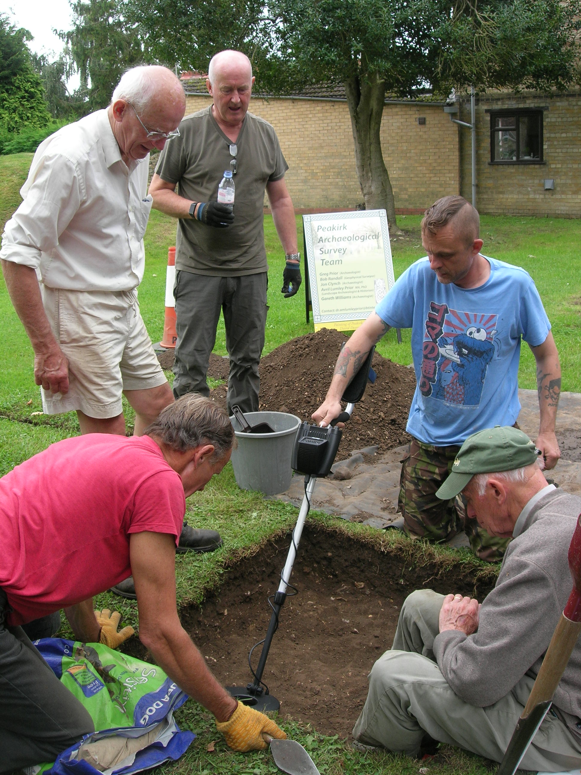
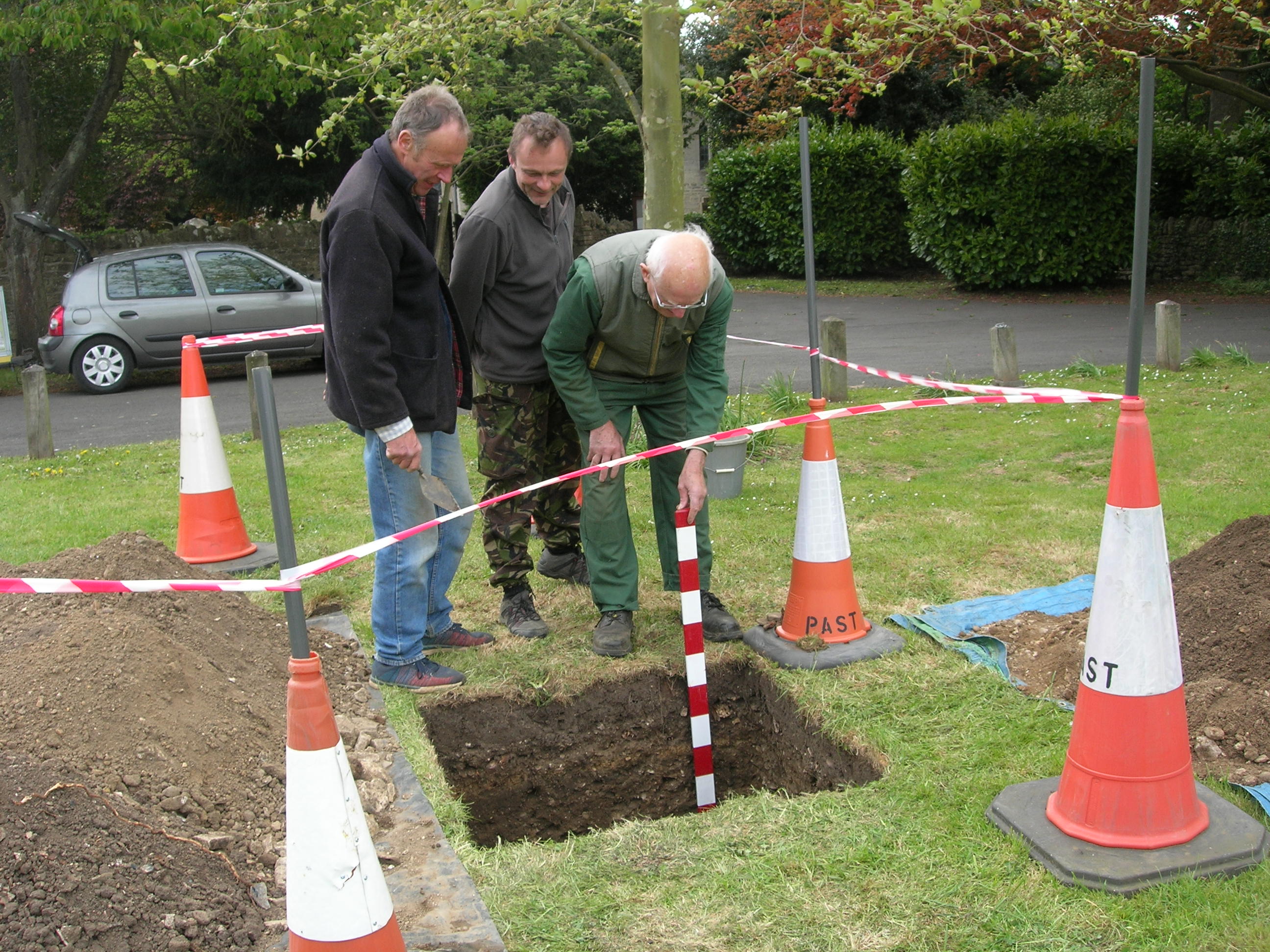
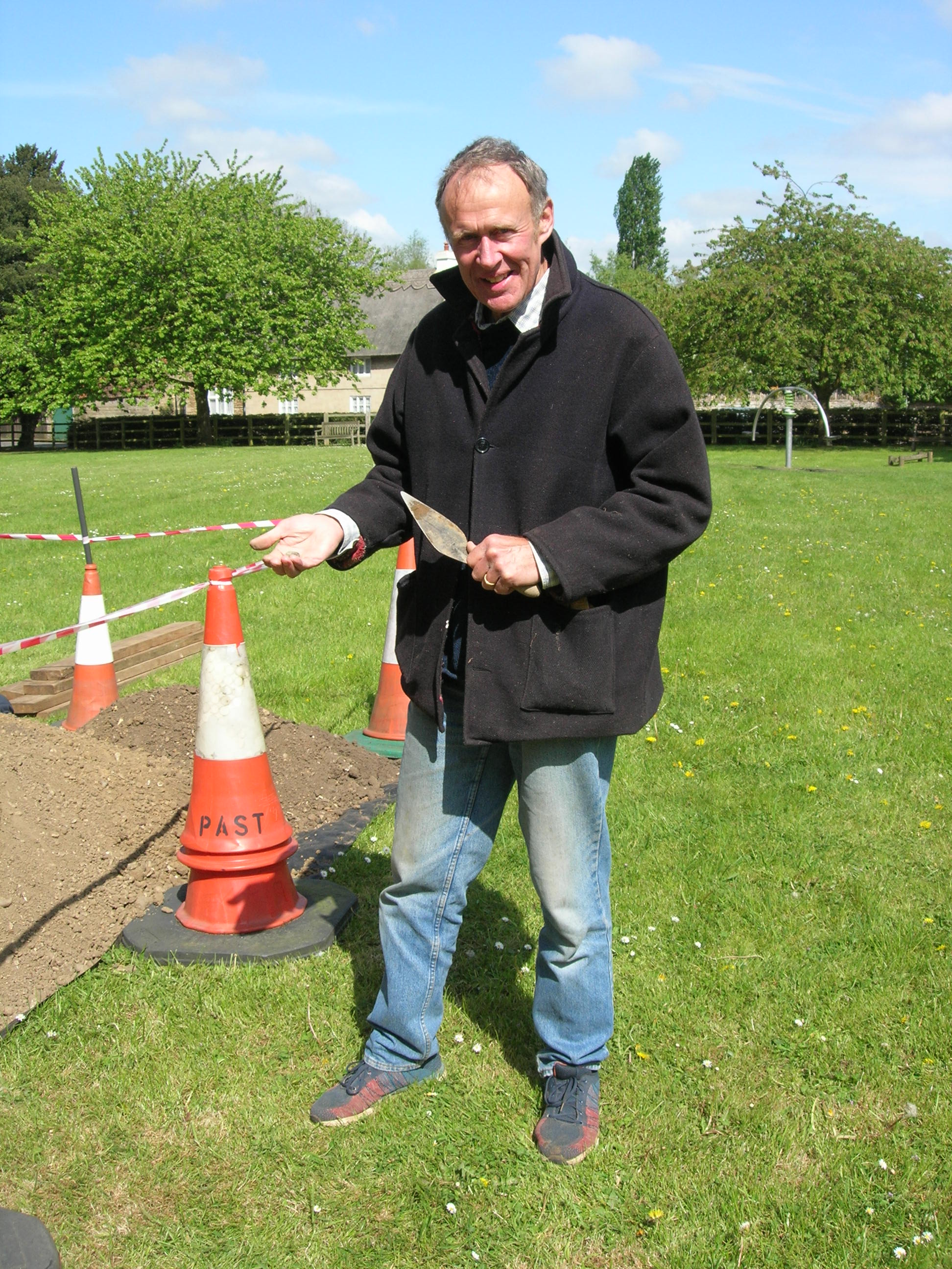
Had it not been for the ‘Inclosure Map’ of 1819, we would never have known about the cottages on the Village Green, sandwiched between Chestnut Close and the Car Dyke. The Ordnance Survey Map informs us that they were gone by 1885 and no evidence survives above ground. P.A.S.T.’s quest was to determine the date of the earliest occupation of the site and when its last dwellings were destroyed. Our geophysical survey on the Green led by Bob Randall, in March 2016, showed an anomaly on the western bank of the Roman watercourse. However, when Greg single-handedly dug a test-pit there, he found only the spoils of a Victorian rubbish dump jumbled up with a few pieces of Romano-British and medieval pottery. The anomaly turned out to be a geological feature! Undeterred, and with the consent of the Parish Council (who own the Green), in April, Greg and I conducted another geophysical survey in the area that we perceived to have been occupied by the buildings. Then in early May, P.A.S.T. sank a second test pit closer to the road this time.
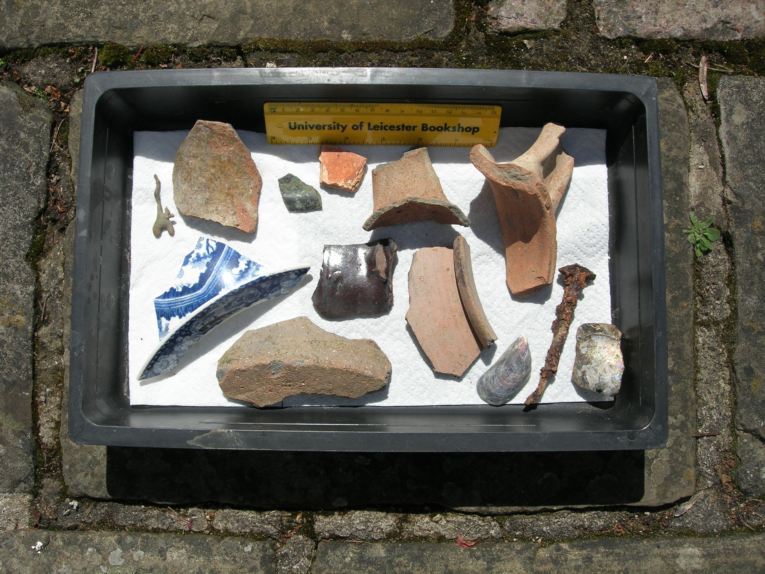
If we had expected to unearth any building-foundations we would have been sorely disappointed. Like many agricultural labourers’ homes, the cottages probably were timber-framed, wattle-and-daub structures set on a stone plinth and roofed with reeds, locally-sourced materials that would have either decayed or been recycled. Indeed, we exposed only minimal amounts of stone, brick and Collyweston tile but numerous pottery sherds from the thirteenth-century onwards, indicating the continuous use of the plots. Then, the eagle-eyed David’s spotted a jetton [trade token], which Gareth identified (on the Portable Antiquities’ website) as from Edward I’s reign (1272-1307). Together with the pottery finds, it gave us a rough date for the earliest habitation of the site. This matched a nationwide period of intensive farming needed to feed a rapidly-increasing population, when even the marginal lands of the parish were cultivated and peasants’ crofts and tofts were squeezed into vacant spaces within the ‘village envelope’. Therefore, we can deduce that by then the Car Dyke had silted up and the drier ground to the west levelled for this purpose.
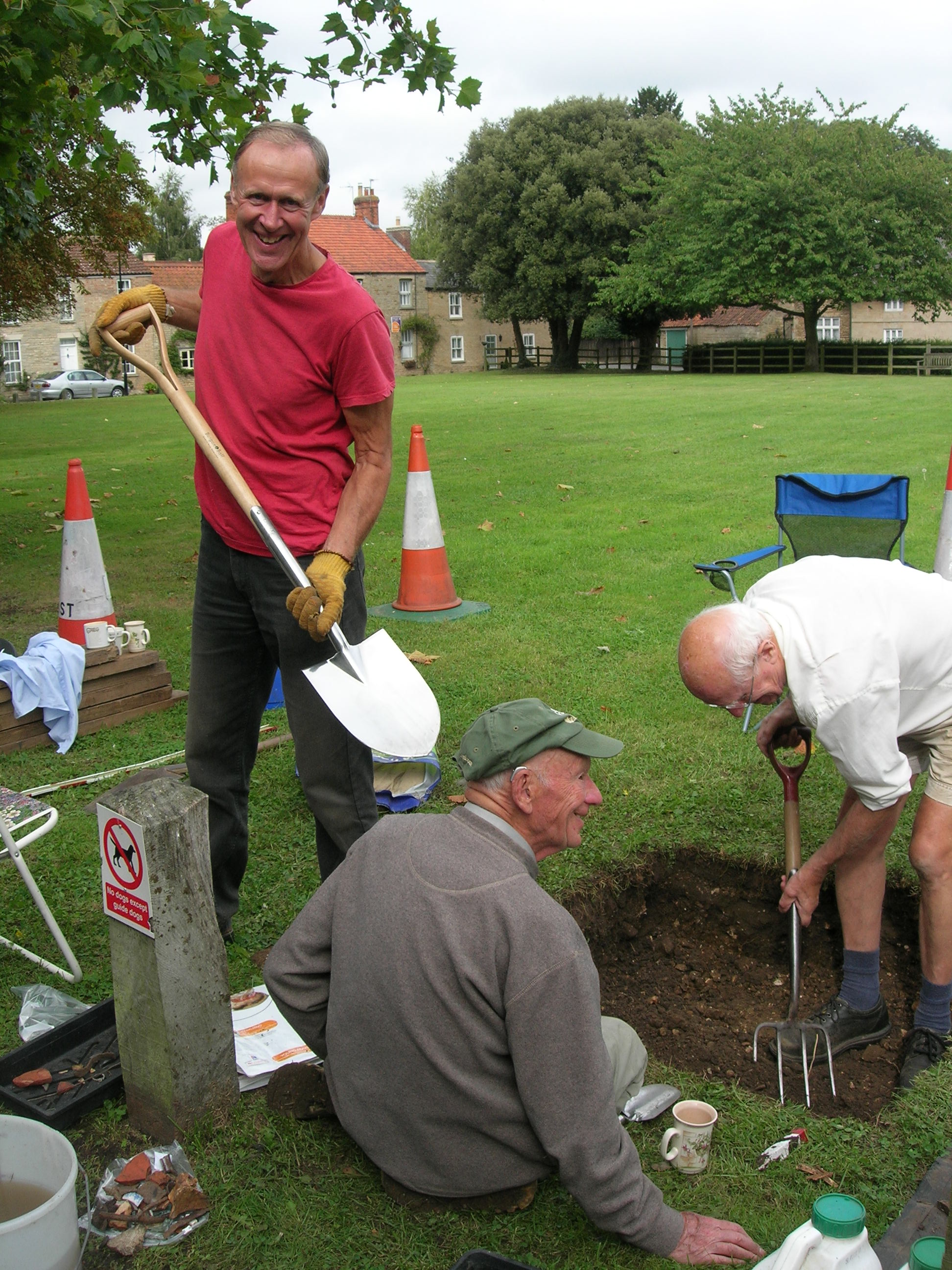
David, Gareth and Greg admire their work
Nevertheless, despite the excavation we were still none the wiser regarding the demolition date of the cottages. Then, as if by chance, whilst preparing P.A.S.T.’s PowerPoint presentation for the May Annual Parish Meeting, I downloaded Greg’s London Illustrated News picture of a ‘Street in Peakirk’, which shows Thorney Road during the floods of 1880. In the background, you can just make out a thatched roof that unambiguously belonged to one of the Chestnut Close dwellings. At last, we know that not only when they first were built in the late 1200s or early 1300s and but also that the last cottages were levelled between 1880 and 1885, possibly as result of flood damage. Our mission had been accomplished.
Ringing the Changes
Among the test-pit finds, was a minute slice from the rim of a small, fifteenth-/sixteenth-century, bronze bell. By astonishing coincidence, whilst researching an earlier Trib. article (101), I discovered an inventory ordered by the teenage Edward VI (1547-53), stating that in 1552 Peykirke church possessed three bells, two in the belfry and one ‘handebell’. Presumably, the latter was rung during Mass as the sanctus to announce the consecration of the bread and wine, the moment when (it is believed) it is transformed into The Body and Blood of Christ. Interestingly, the Commissioners’ report adds that ‘The ‘Pancake-bell is rung on Shrove Tuesday. On Sunday, a bell is rung at 7am and again at the conclusion of Divine Service’.
Although Edward was intent on enforcing his own brand of fundamental Protestantism, he reluctantly suffered steeple bells to be tolled for purely functional reasons such as summoning parishioners to church and to state proclamations. In contrast, he denounced their ritual chiming during services as papist or Catholic customs. (I’m not so sure that he would have approved of pancake-racing either.) Consequently, Edward ordered hand-bells to be smashed in situ, lest they should be spirited away for use during clandestine Masses. Of course, it would take a tremendous leap of faith to purport that we had recovered a tiny fragment of Peakirk church’s lost hand-bell. Like St Pega’s final burial-place, its provenance must remain a mystery.
Romancing St Pega?
Perplexingly, the bulk of our knowledge of St Pega is gleaned from post-Conquest accounts written expressly to promote Guthlac’s shrine at Crowland as a centre of pilgrimage. The monk, Felix, writing at Repton c.735, gives Pega only an almost will-o’-the-wisp-like appearance his Life of St Guthlac. He simply divulges that she was summoned from her hermitage to officiate at her brother’s funeral, deposit his undecayed cadaver in a sarcophagus a year later and to perform a miracle on his behalf. Afterwards, the lady vanishes and we must wait until c.1125 for the Anglo-Norman historian, Orderic Vitalis, to provide us with the next instalment. Basing his version of events on information supplied by the monks of Crowland (who gave him hospitality and paid his fee), Orderic relates that immediately after Guthlac’s second funeral Pega went on a pilgrimage to Rome, where she died on 8 January 719. Her disciples buried her in a church consecrated in her memory, which rapidly became a hot-spot for more miracles. ‘Ingulph’ who concocted his forged Crowland Chronicle in c.1416, allows Pega a brief sojourn at her hermitage ‘four leagues to the west’ of Crowland (indubitably Peakirk) before dispatching her to Rome. He adds that upon her arrival all the bells in the city rang out in recognition of her piety. According to tradition, the church where she was entombed collapsed through neglect during the seventeenth century with the loss of all her relics.
Here, we hit an enormous snag. Nowhere in the meticulously-kept Vatican Archives is there a single reference to St Pega’s church in Rome. In fact, it is only Crowland sources that suggest that she ever went to the Eternal City in the first place. What then if Peakirk’s patron saint had ended her days in her cell ‘four leagues’ from Crowland, was buried in her own chapel (customary for hermits) and her shrine became a pilgrim attraction to rival St Guthlac’s? Were the brethren of Crowland deliberately attempting to suppress Pega’s Peakirk her cult by claiming that she was buried elsewhere?
Yet, if Pega were buried in Peakirk, what became of her relics? Again, we may have to lay the blame at Edward VI’s door. Contrary to his father, Henry VIII, who primarily Brexited from the Church of Rome to divorce Katharine of Aragon and marry Anne Boleyn, Edward was hell-bent on eradicating all vestiges of the ‘Old Religion’. He regarded the veneration of ‘holy bones’ as superstitious and akin to witchcraft and pagan practices and demanded that they must be rooted out and eradicated. It seems likely that should Pega have been laid to rest in the settlement that was later was to bear her name, her shrine would have been destroyed and her remains scattered.
When the church was founded in 1014/15, it originally was consecrated in the honour of the Blessed Virgin Mary, The Holy Trinity and All Hallows [Saints]. By the thirteenth-century, its dedication had been whittled down to All Saints, which again would have been a tad too Catholic for Edward’s taste. Perhaps, as a concession he permitted the church to be rededicated in the honour of St Pega, an austere fenland anchoress who obviously had close connections with the village. And so, despite the loss of her earthly remains, nostalgia for her earlier church was perpetuated.
P.A.S.T.’s Future Projects
Of course, it is highly-improbable that P.A.S.T. ever will unlock the secret of St Pega’s final resting-place. Instead, we must concentrate on reporting and publishing our findings, hopefully reveal more about the crop-marks in Bull Lane paddock and explore any avenues where our adventures into Peakirk’s historic environment lead us. We already have permission to excavate a third test-pit on the Village Green and if you see us busily trowelling away there, please, come and chat to us. Visitors are always welcome when we are on site . . . and you never know what we might have dug up!
Some aspects of this article were presented at the Peakirk Annual Parish Meeting on 8 May 2017. P.A.S.T. is grateful to Professor Stephen Upex for his advice and expertise in identifying our finds.
Past Times in Peakirk: A Romano-British ‘Villa’?
By Greg Prior
Peakirk must have looked considerably different back in 60AD, when the occupying Roman legions first made their mark on this backwater of Britannia by cutting the Car Dyke through what is now the heart of the village. The influx of foreigners would have come as a huge culture-shock to the indigenous population, who were still living in – and continued to live in – Iron-Age style round houses. In contrast, archaeological evidence indicates that by the third century, villas had been established along the margins of the Lincolnshire fens. They were occupied by Romano-Brits who were engaged in land reclamation and the production of salt, a commodity so vital for food preservation that it was used to pay part of a legionary soldier’s salary. So, were there any villas in Peakirk, then?
Well, when we held our archaeological Digs with Professor Carenza Lewis back in 2012, so much Romano-British pottery was unearthed that it was concluded that there must have been a strong Romano-British presence here from at least the third century onwards. Moreover, the discovery of an amphora and other pieces of high-status pottery in the grounds of the Old Rectory in 1913 and 1919 suggest that there probably was a significant farmstead or villa very close by. Imagine my consternation last May, when rumours began to circulate that buried beneath in the paddock next the Rimmers’ old place in Bull Lane was the remains of such a villa. Indeed, images from Google Earth showed a series of crop-marks so convincing that they had attracted ‘night-hawks’ [unofficial metal detectorists] whilst the property stood empty.
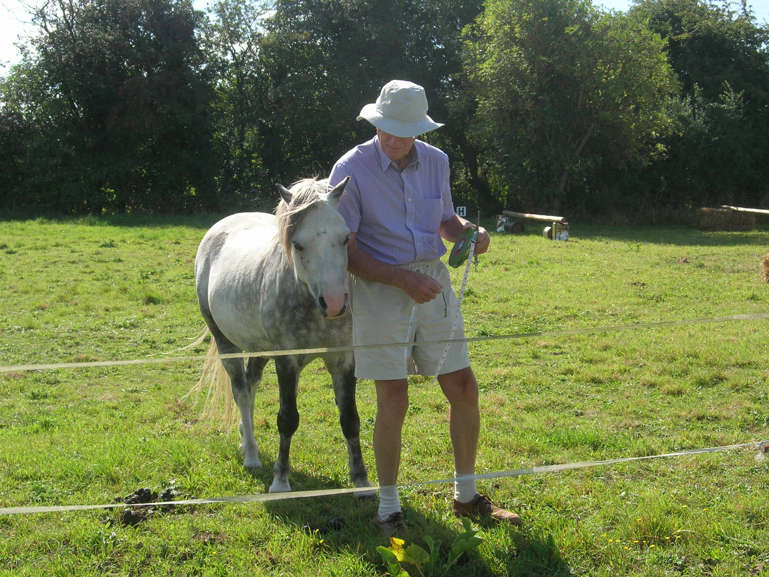
Once the new owners had settled in, I introduced myself and familiarised them with the work of P.A.S.T. [Peakirk Archaeology Survey Team]. They immediately granted us permission to conduct a resistivity survey on their land with the possibility of test-pitting later. Fellow P.A.S.T. member and geophysicist, Bob Randall, lent us his equipment and over the summer, Avril and I carried out an extensive resistivity survey, discovering that the section closest to the house yielded the greatest levels of resistance. As shown in the photograph, we caught the attention of a pony, who was fascinated by the elderly gent pacing up and down with a tape-measure and frame, just like on Time Team.
Both Bob and Avril were sceptical that this was a villa site. Bob conjectured that the high resistance was no more than a pile of rubbish. Avril proposes that the archaeology of any Romano-British villa/farmstead lies beneath St Pega’s church and graveyard. Nevertheless, towards the end of March 2017, we sank a metre-square test pit. This time, we were ably assisted by Gareth Williams, who has since joined our Team. Meanwhile, Avril recorded the finds, filled in the Access Cambridge Archaeology booklet and wrote a detailed report for posterity. Disappointingly, as soon as we lifted the turf, we realised that Bob’s theory was correct. The area of high resistance shown on our readings was the hardcore of an early twentieth-century crew-yard. Undeterred, we pressed on with David Hankins joining us at this point. At a depth of 70cm, we hit a domestic tip complete with the remains of a galvanised bucket, the shattered lid of an early twentieth-century water-filter, several rusty beam-bolts, sherds of ubiquitous blue-and-white Victorian crockery, bits of clay-pipe, Virol jars and various medicine and broken mineral-water bottles. As a collector of old bottles, I recognised that one came from Smith of Bourne, who was in business between 1904 and 1917, conveniently narrowing down the date of the refuse dump. The crew-yard must have been laid shortly afterwards.
Three men in a hole: Greg, David and Gareth
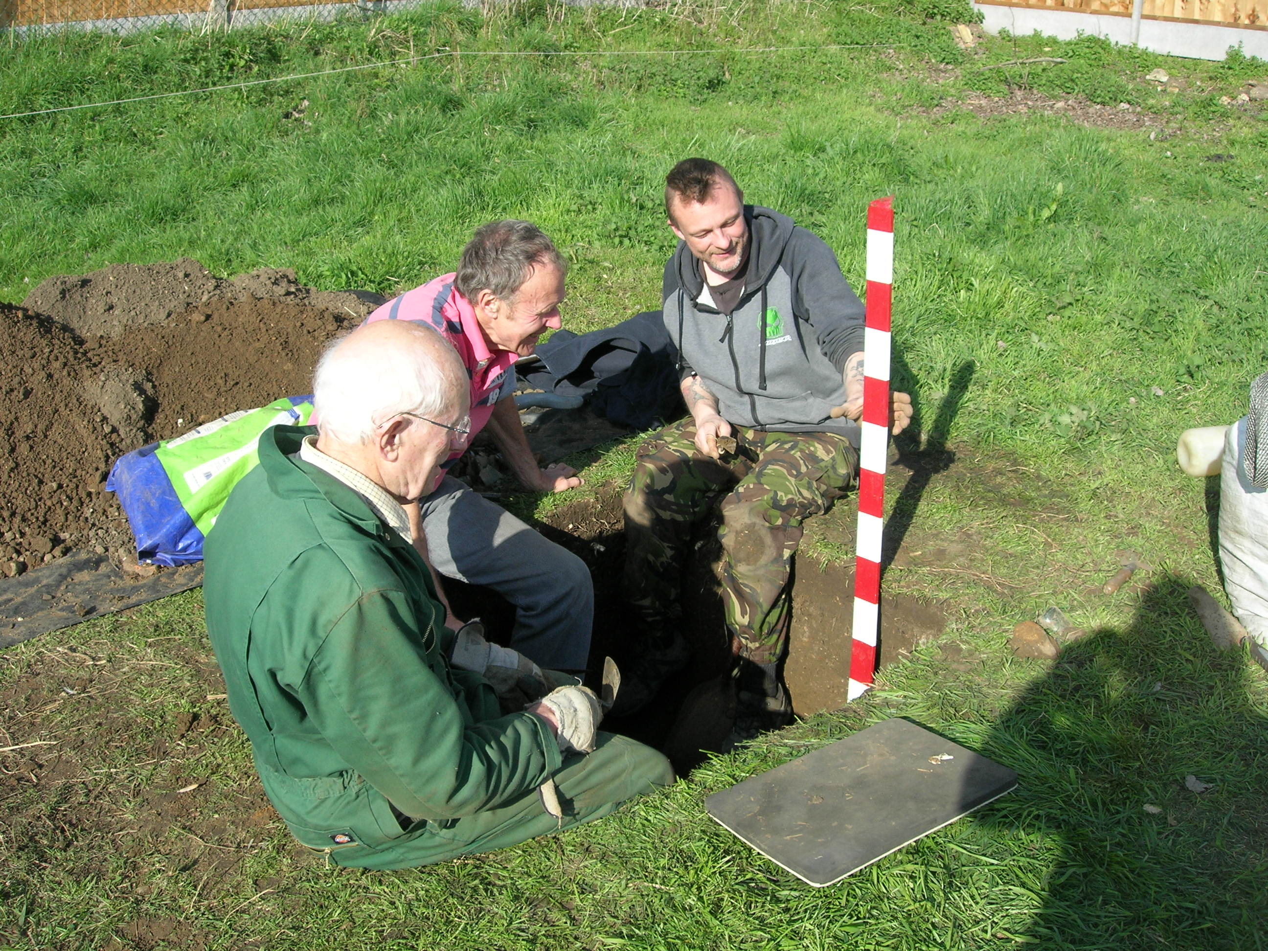
We carried on digging to a depth of one metre before reaching the ‘natural’ [undisturbed ground]. For me, the most interesting find was part of the rim of an early thirteenth-century pot, decorated with a finger-nail and a thorn-like object. It also was our earliest dateable evidence. Regrettably, we found no signs of any Romano-British activity on the site. However, it must be remembered that our excavation represented only a snapshot view and further test-pitting is essential. Please, watch this space as we hope to return to the site in Spring 2018.
P.A.S.T. would like to thank the owners of Bull Lane paddock for allowing us access to this strictly-private site and Professor Stephen Upex for identifying the finds.